

Al Jazeera
November 8, 2013
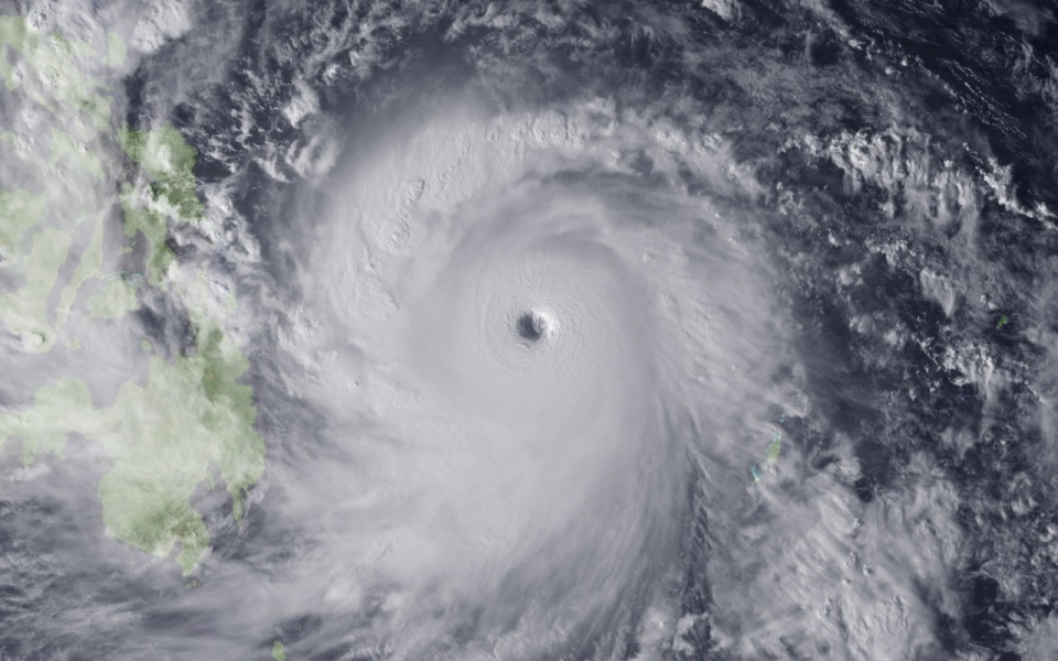
One of the most powerful typhoons ever recorded slammed into the Philippines early Friday, with one weather expert warning of potentially catastrophic damage. Early reports are that at least four people are dead, but with power and phone lines cut to the country’s central region, communication is difficult, and officials expect the death toll to rise. As of Friday morning, more than 700,000 have been evacuated from the storm’s path .
Shortly before landfall of Typhoon Haiyan (known locally as Yolanda), the U.S. Navy’s Joint Typhoon Warning Center said its maximum sustained winds were 195 mph, with gusts up to 235 mph.
“195 mile-per-hour winds — there aren’t too many buildings constructed that can withstand that kind of wind,” said Jeff Masters, a former hurricane meteorologist who is meteorology director at the private firm Weather Underground.
The Emergency Election Sale is now live! Get 30% to 60% off our most popular products today!